
Example - winter wheat with 3 seeding dates
This Atfarm image shows a field with 3 different seeding dates. You can clearly see 3 clear zones with low to high biomass. With Atfarm you can easily follow how these differences get bigger or less.
Satellite images will not be able to tell you what the problem is but help you decide to have a closer look and then decide on the right actions.
How Atfarm works
Add your fields
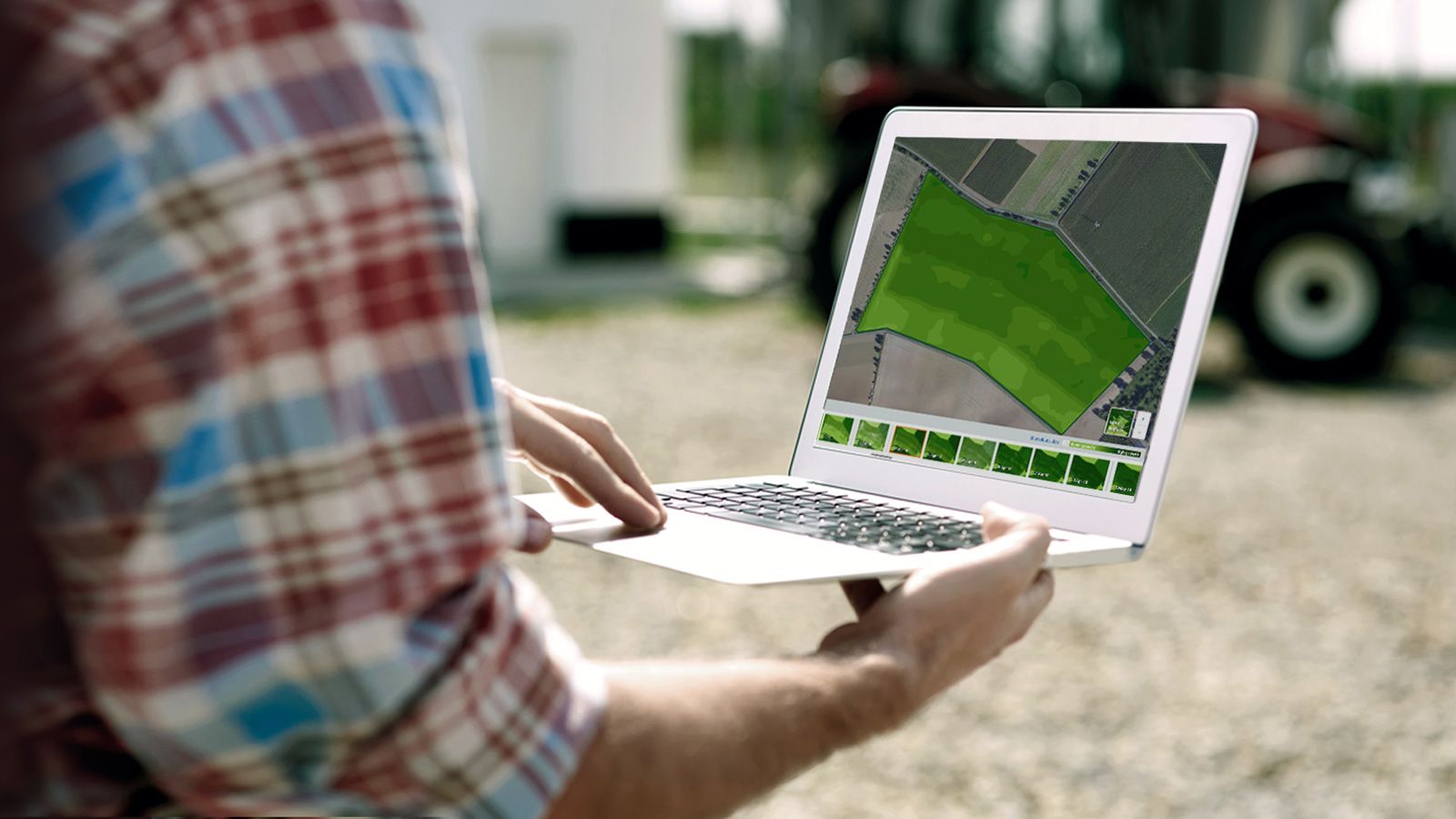
Draw your fields and access satellite images analysed with Yara N-Sensor technology.
Start growth monitoring
Monitor the biomass of your fields with Atfarm and use the Yara N-Sensor index to make more informed decisions.
What customers are saying about Atfarm


Frequently asked questions
European satellites take pictures of the whole world every 2-4 days. Atfarm translates these into biomass maps.
Atfarm helps you to plan your field trips more efficiently by checking the fields from your computer before you go there:
- Which field seems to grow slower and need a check?
- Which areas in the field need a closer inspection?
- If I need to take a sample in the field, where is the best place?
- Atfarm will not solve crop problems but helps you to find out quicker. When you know where they are, you can try to fix them. Some can be fixed this season, but others possibly only for next season or never. This depends on the cause.
A satellite can not see through clouds. Atfarm automatically filters out these images. Sometimes a small cloud is visible. This image can not be used. Luckily images are taken every 2-4 days, so the cloud problem is smaller than with earlier satellites.
Like in Google Maps, this detailed map is made from images taken from an airplane. This is expensive and usually paid by local governments. Therefore these maps can be 1 to 10 years old.
In very rare situations, there can be images with a few clouds. In that case, please send an email to hello@at.farm .
Biomass is the same as crop development. In the bottom right corner of the map, next to the zoom buttons you see a square. When you click on it, you see 4 options:
- Base map: used to draw your field borders
- Field view: actual satellite image in true color. You can actually see from the satellite what the real color is of your crop. For example, you can see a brown field turning green, or a green cereal field starting to turn yellow-brown getting ready for harvest. This view is not well suited to show different shades of green. The next two options are better for that.
- NDVI biomass: biomass, or crop growth is calculated from different information (wavelengths) from the satellite images. Differences are clearly visible in different shades of green. NDVI is the best choice in the early development of the crop. Later the whole field turns dark green and differences are no longer visible. This is the time to move over to Atfarm’s unique 4th option: N-Sensor biomass.
- N-Sensor biomass: Atfarm is unique here to show differences in a well-developed crop. For early growth stages, option 3 is better. Take care: the color range goes from brown over green and blue to pink. A bare field will show as dark brown, but a young crop will display as lighter shades of brown. This might be confusing in the beginning.
Biomass is the amount of green crop growing in your field. This is calculated from different information (wavelengths) from the satellite images.


